|
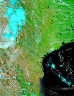
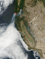
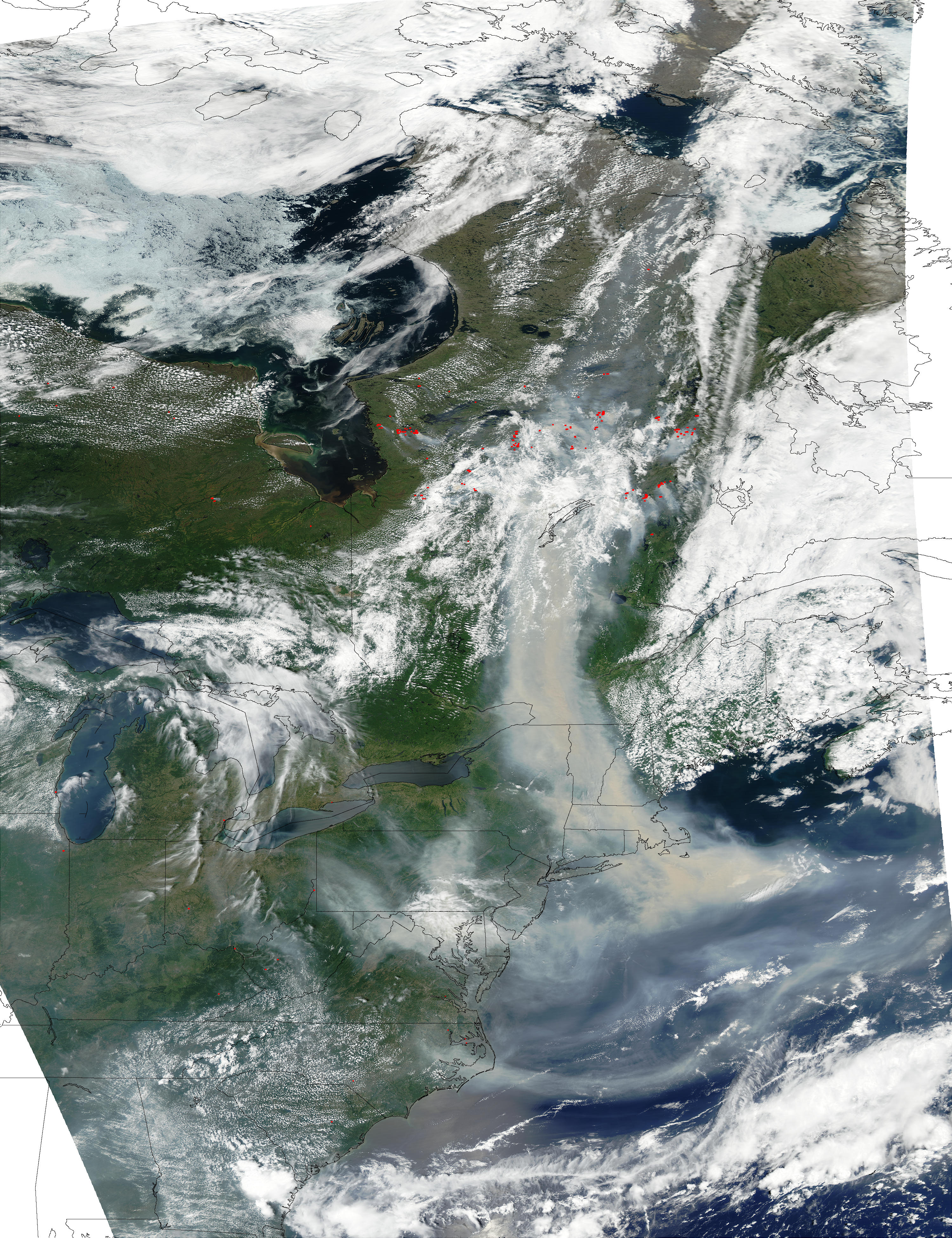
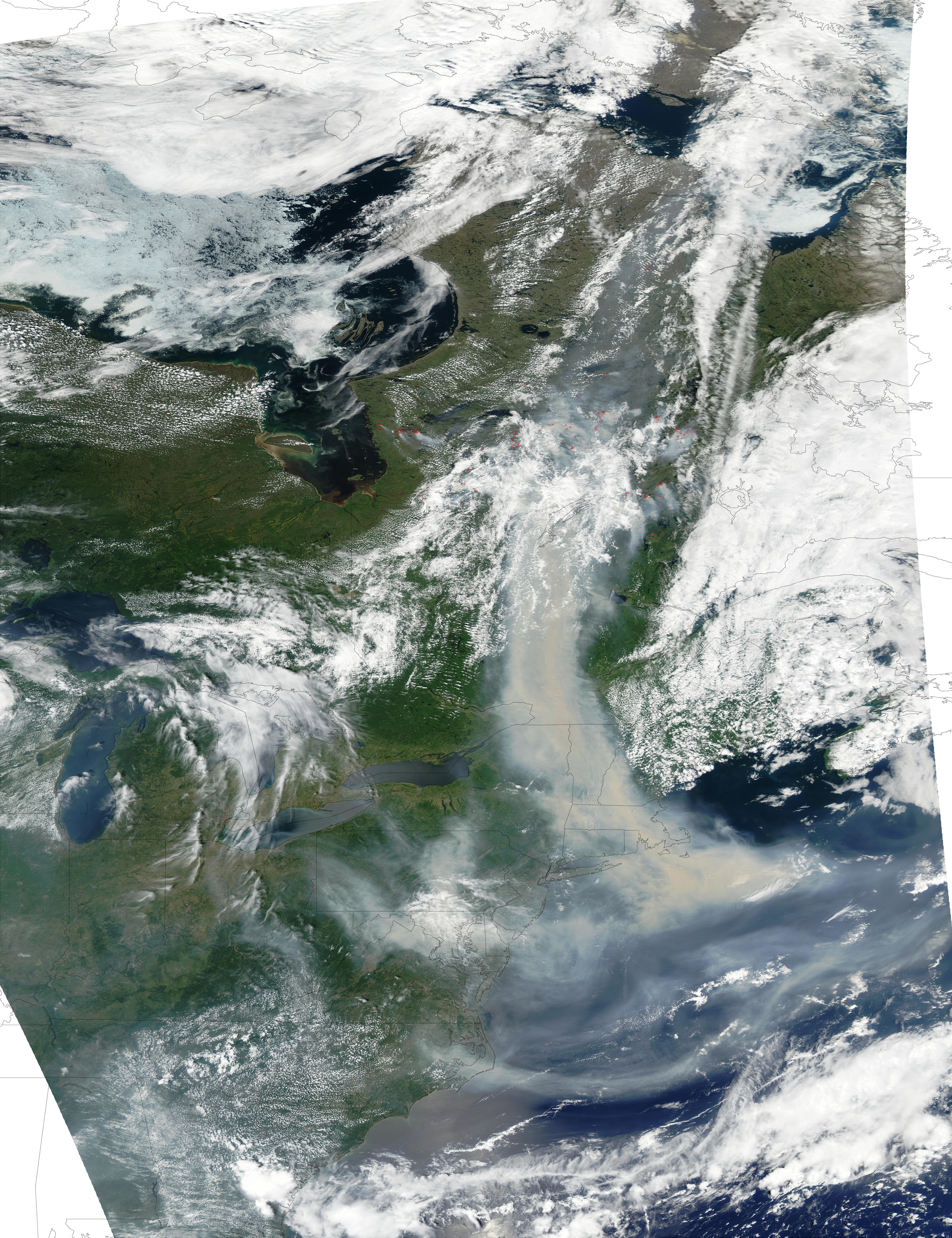
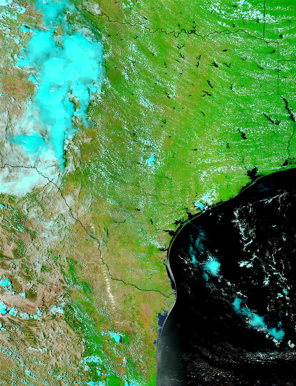
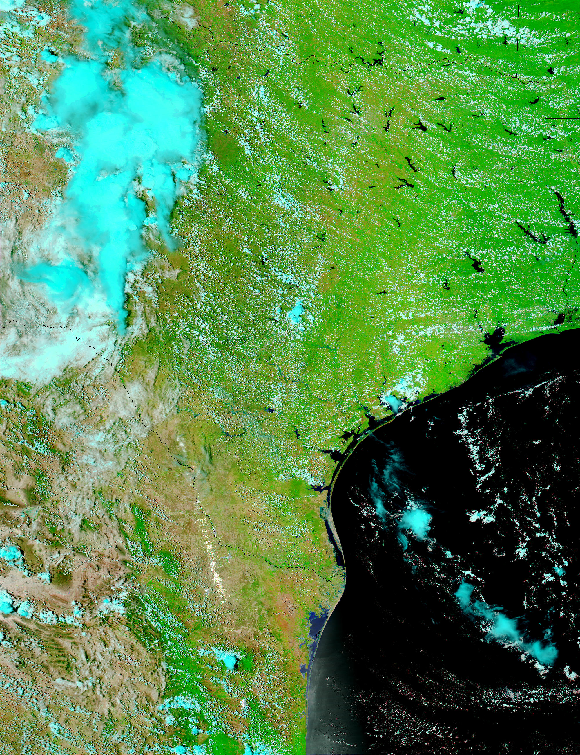
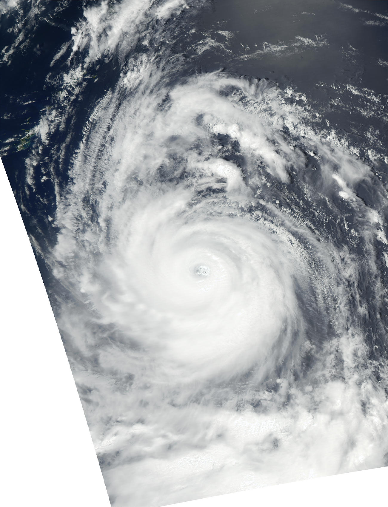
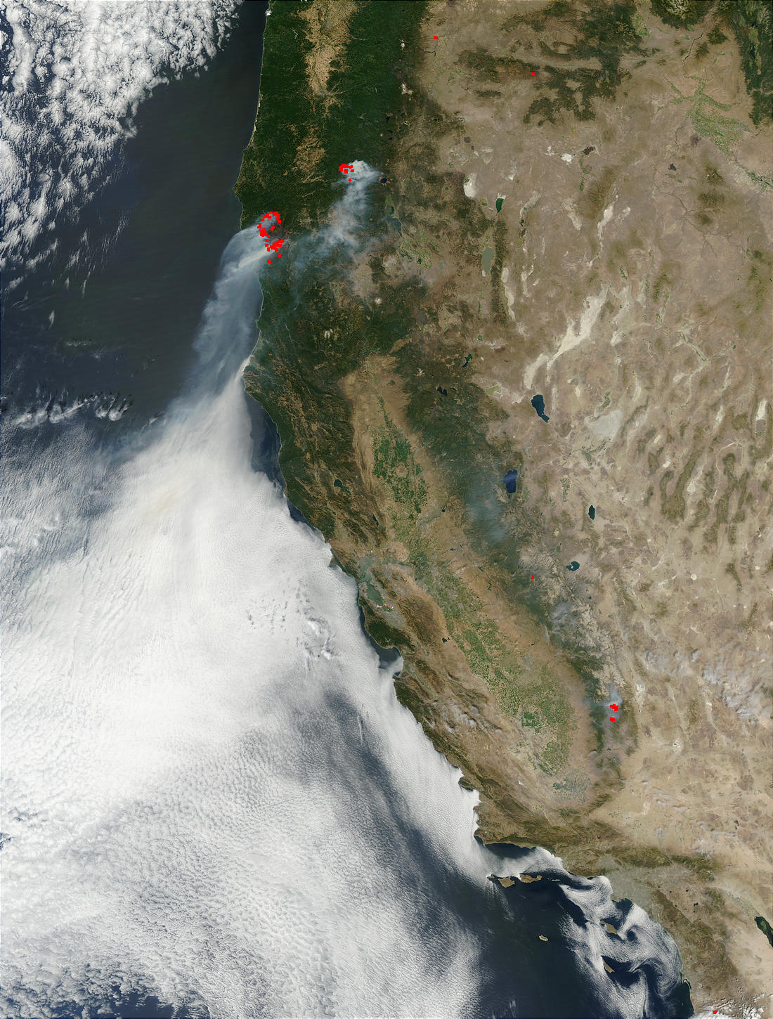
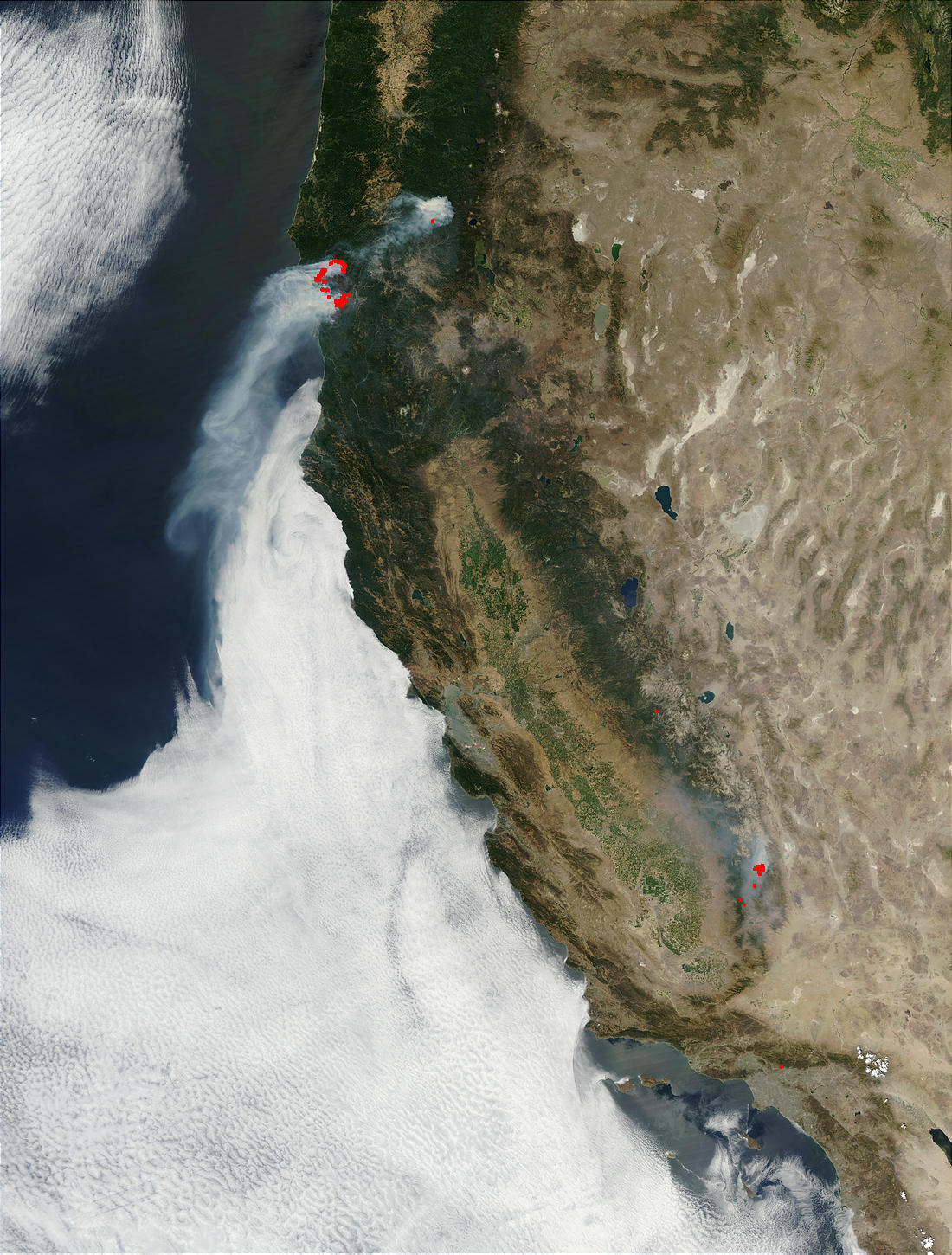
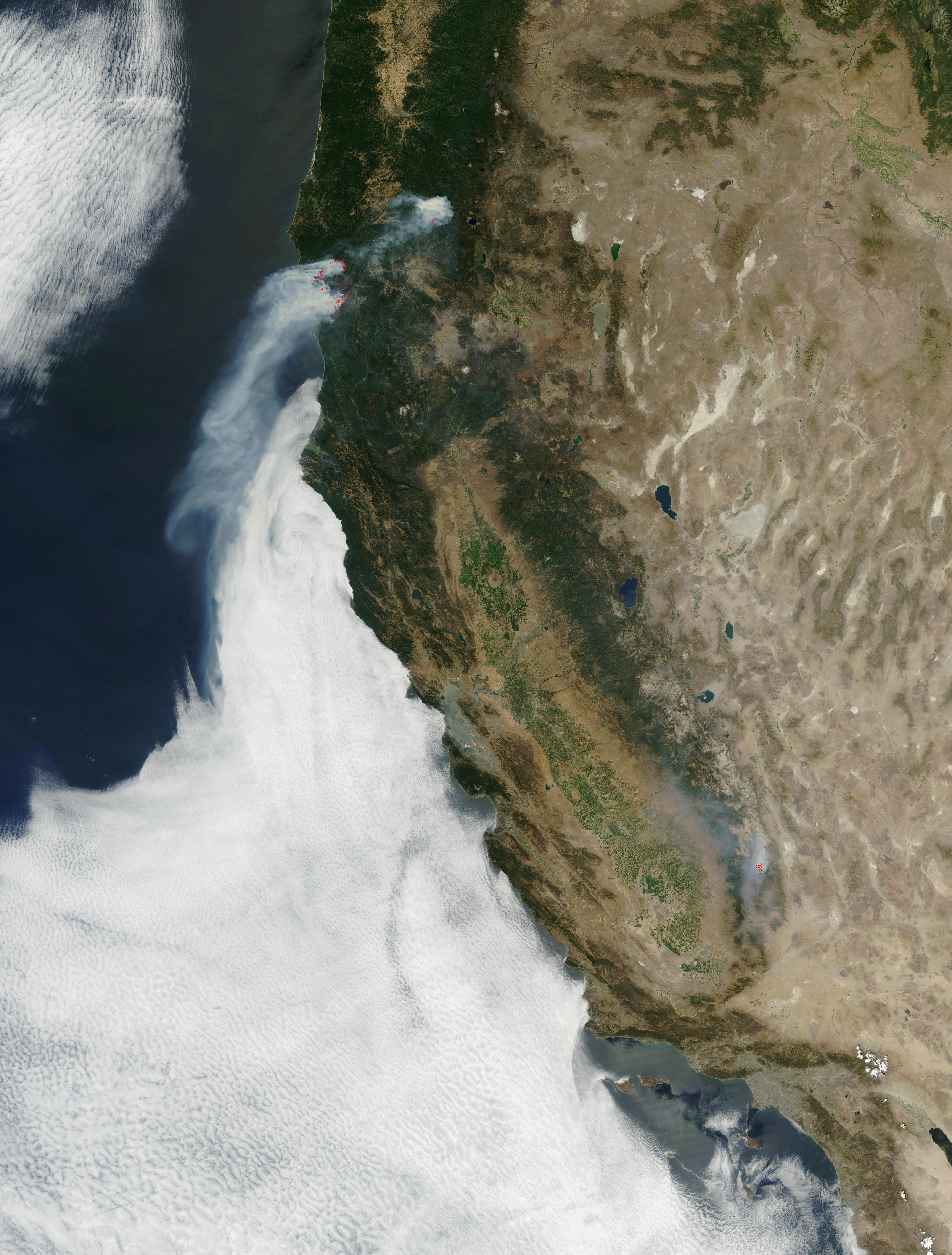
Elvia Thompson Lynn Chandler RELEASE: 02-157 INSTRUMENT ABOARD NASA’S AQUA SATELLITE JOINS TWIN TO BEGIN COMPREHENSIVE GLOBAL COVERAGE Roughly 438 miles above the Earth, the Moderate Resolution Imaging Spectroradiometer (MODIS) instrument aboard NASA’s Aqua satellite opened its Earth-view door on June 24 and took its first look at our planet. This event, called “first light,” marks a milestone in Earth observation, allowing scientists to conduct the most comprehensive daily examination of our planet by combining data from two MODIS instruments on sister satellites in Earth orbit. Like its twin flying aboard NASA’s Terra satellitelaunched in 1999Aqua MODIS sees almost the entire surface of our planet every day in 36 channels ranging from visible to thermal infrared wavelengths. Where as Terra descends across the equator at 10:30 a.m., Aqua ascends across the equator at 1:30 p.m. The different timing of the satellites’ pole-to-pole orbits enables scientists to focus on different aspects of the Earth’s climate system and to see changes within the system during the course of a day. “With the launch of Aqua,” said MODIS Team Leader Vince Salomonson, of NASA’s Goddard Space Flight Center, Greenbelt, Md., “we are able to observe land, ocean and atmosphere phenomena in the afternoon with Aqua and in the morning with Terra. This is especially important for observing rapid, time-varying phenomena like clouds and water vapor.” Understanding the processes of water evaporation, the movements of water vapor (the dominant greenhouse gas) throughout the atmosphereand the relationship of these processes to cloud formationis essential to climate and local weather modeling. In its first weeks of operation, Aqua MODIS observed significant Earth events occurring all over the globe. Even as Super Typhoon Chataan was rapidly approaching Japan, there was severe flooding in southeast Texas, and a vast, thick pall of smoke from Canadian wildfires blanketed almost the entire U.S. East Coast. MODIS collected and beamed to Earth these images in very-near real time. Data from Aqua MODIS will augment scientists’ ability to track wind and clouds in the polar regions where current weather satellites can’t see, helping meteorologists to better monitor and predict global weather patterns. Aqua MODIS will also dramatically improve scientists’ ability to monitor the daily (diurnal) cycles of the large-scale burning of plant biomass in regions all across the planet. “Aqua MODIS will complement Terra, providing four observations per day that will better sample the daily cycle of fire activity and provide increased opportunity of cloud-free observations,” said Chris Justice, the MODIS Land Team Leader at the University of Maryland, College Park. Using Aqua MODIS, scientists can gather more data on how fast and in which direction fires are spreading, as well as how severely a given fire may affect air quality of downwind urban areas. Aqua MODIS data have worldwide applications. The MODIS team is working with the Global Observation of Forest Cover/Gold-Fire Program and the World Fire Monitoring Center to provide fire data to the international community. Team members collaborate with fire monitoring groups in Australia, Botswana, Brazil, Malaysia, Mexico and Russia. Having a second MODIS instrument will also improve ocean-based research. “Aqua will provide continuity of important observations of sea surface temperature and ocean color, which is a marker of the biochemistry of marine organisms,” Salomonson added. Aqua and Terra each carry a MODIS instrument designed to gather planetary data across 36 spectral bands. Data will be processed into 44 distinct data products available to the world for use in tracking global climate change. The satellites are part of NASA’s Earth Science Enterprise, a long-term research effort to understand and protect our home planet. Through the study of the Earth, NASA will help provide sound science to policy and economic decision-makers to improve life here, while developing the technologies needed to explore the universe and search for life beyond our home planet. For more information and images, see: http://www.gsfc.nasa.gov/topstory/20020815aquafirst.html For the more on the MODIS Instrument, go to: http://modis.gsfc.nasa.gov |
|
MODIS First-Light Images


News Date:
Thursday, August 15, 2002
News Type: