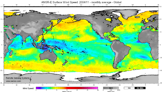
This false-color image of sea surface wind speed was made using data taken by the Advanced Microwave Scanning Radiometer-EOS (AMSR-E), aboard NASA's Aqua satellite, and composited for the month of November 2004. AMSR-E was provided to the Aqua program by the Japanese Aerospace Exploration Agency (JAXA).
The sea surface wind speed product is derived from sea surface roughness (wind stress) and represents an approximation to the wind speed at 10 meters above the surface. The spatial resolution of this data product is 20 kilometers and only the scalar wind speed is provided because the wind direction is not retrievable. This product is available for both clear and cloudy conditions, but not for areas containing rain, sun glint, or sea ice.
Image courtesy of Remote Sensing Systems, Santa Barbara, California.

